
Collections/Theme
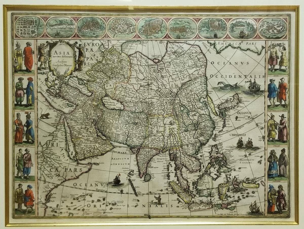
Asia
| 時間 | 1617, printed in 1650 |
| 尺寸 | L. 41.5 cm, W. 56.5 cm |
| 標籤 | MM3429 |
| 作者 | Willem Janszoon Blaeu |
Authored by Willem Janszoon Blaeu (1571-1638), this geographic map of Asia was included in Atlas Maior published posthumously, considered at the time the most comprehensive and the most expensive. Blaeu was a representative figure during the heyday of Dutch cartography in the 17th century, serving as a cartographic officer for the Dutch East Indian Company.
On the map, Macao is marked in the east of the Pearl River estuary, and many other islands nearby were also located. Asian figures were placed on both sides of the map. Views of Macao and other cities were depicted at the top.
Copperplate print with colours.
Related Items


Explore Other Collections

Donate historical relics to leave footprints for future generations
